|
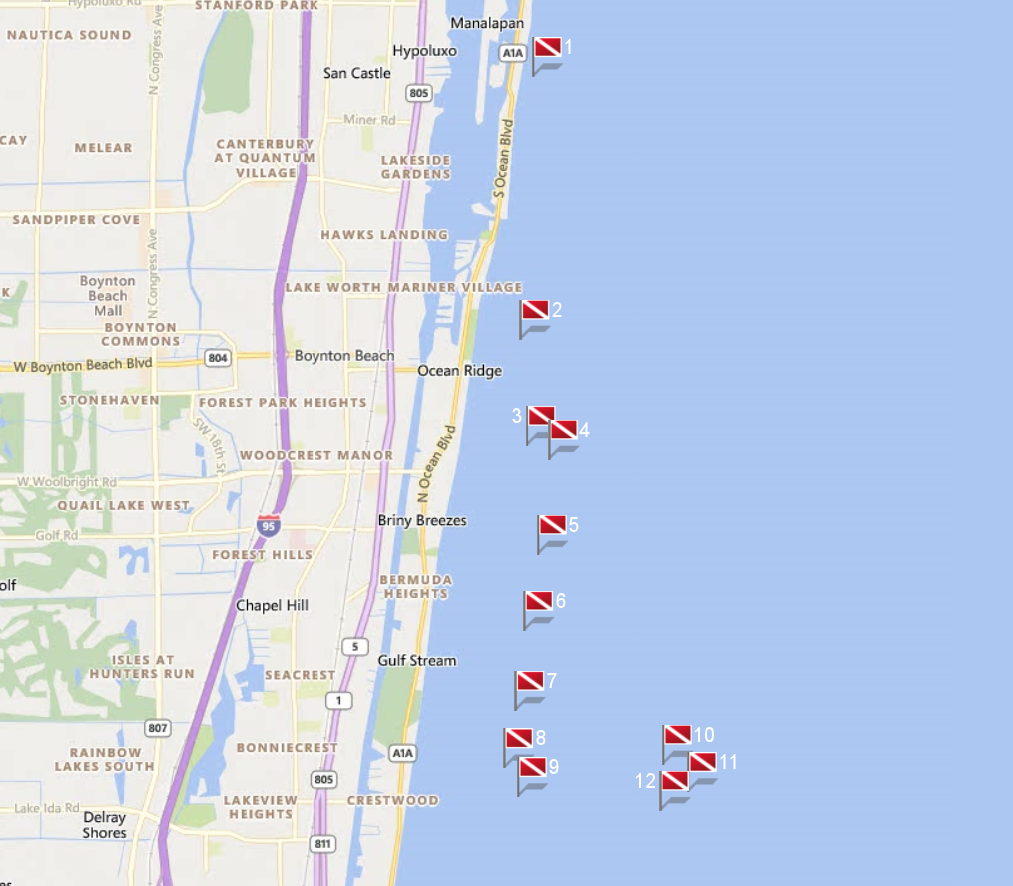
Site Name |
Dive Type |
Difficulty |
GPS |
Max Depth |
Map |
|
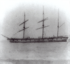
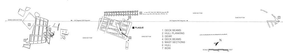
1 |
Lofthus |
Wreck |
Novice - Intermediate |
26°33.767 N
80°2.300 W |
20' |
|
| |
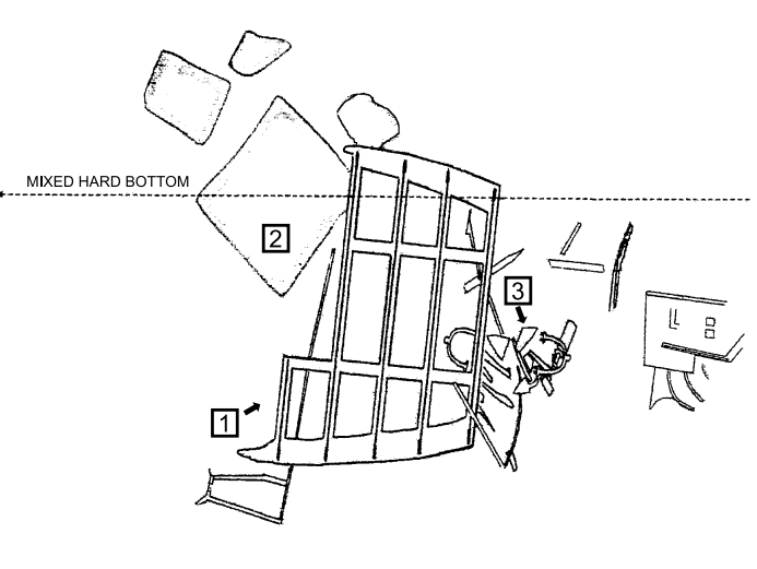
Built in 1868 in Sunderland, England by T.R. Oswald, the 222-foot iron-hulled vessel was originally
christened Cashmere and rigged as a three masted barque. She was painted with false gunports to ward off pirates. After a career in the East Indian trade,
Cashmere was sold to a Norwegian firm, renamed Lofthus, and used in the American trade.
On February 4, 1898, the Lofthus wrecked in a storm
en route to Buenos Aires from Pensacola. The crew of 16 men, as well as the ship's cat and dog, were rescued by the passing vessel Three Friends, which was
smuggling guns to Cuba. The ship, however, was declared a loss as it could not be removed from the shallow reef. The cargo, primarily lumber, was salvaged
and brought ashore by locals and reportedly used to build homes in the Boynton Beach area.
On January 6, 2004, it was added to the U.S.
National Register of Historic Places and was officially designated as the eighth Florida Underwater Archaeological Preserve (and Palm Beach County's first)
during a ceremony at Boynton Beach Intracoastal Park. During the ceremony, former Historical Society of Palm Beach County president, Harvey Oyer, presented a
brief history of the ship and the wreck. According to the historical society, Oyer's great-great grandparents were among the first to board the grounded ship
and help salvage its cargo before it sank.
Markers - None.
Details - The ship rests in 15 to 20 feet of water with wreckage rising as much as six feet off the sea floor depending on sand movement. Large
sections of the wreck site are scattered across an area approximately 290 feet long by 50 feet wide, with the bow, midships, and stern separated into three
distinct areas. Parts of the wreckage may be entirely covered or completely exposed contingent on waves, currents, and storm conditions.
Marine Life - Caribbean spiny lobster, cubbyu, grunts, jacks, porcupine fish, porkfish, snapper, stingrays, and wrasse.
Recommended Certifications - Open Water, Advanced Open Water, Enriched Air (Nitrox), Boat, Drift, Peak Performance Buoyancy, Wreck, Coral Reef Conservation. |
|
|
|
|
|
|
|
|
|
2 |
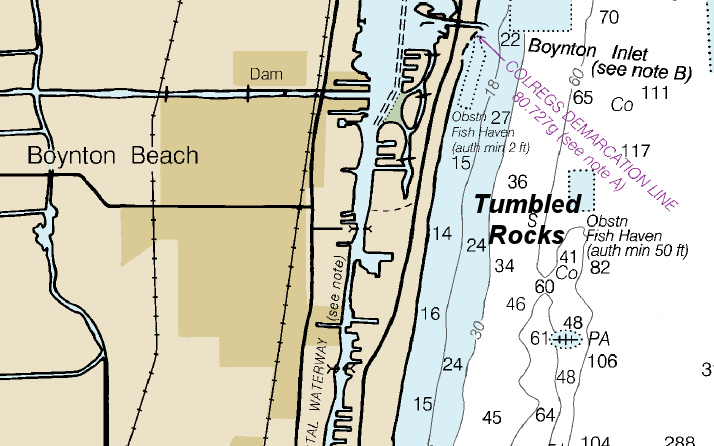
Tumbled Rocks |
Reef |
Novice - Intermediate |
26°31.838 N
80°2.413 W |
69' |
|
| |
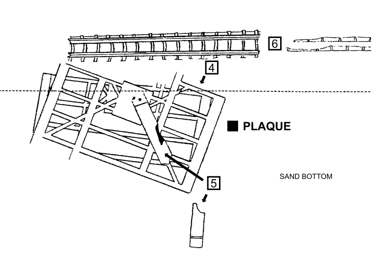
As it's name suggests, the site is composed of sand-tumbled limestone rocks broken off of the Boynton Ledge.
Markers - None.
Details - This location suits all diving levels, offering great visibility. However, strong currents are common here.
Marine Life - Large barrel sponges, sea whips, sea fans, yellow tube sponges and purple gorgonians.
Recommended Certifications - Open Water, Advanced Open Water, Enriched Air (Nitrox), Boat, Drift, Multi-Level, Peak Performance Buoyancy, Coral Reef Conservation. |
|
|
3 |
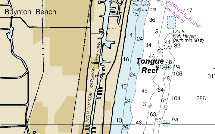
Tongue Reef |
Reef |
Novice - Intermediate |
26°31.060 N
80°2.356 W |
60' |
|
| |
Markers - None.
Details - Current is light but can be strong at times. The reefs are usually best in the 45-60 foot range.
Marine Life - Tropical fish, hammerhead shark, nurse shark, turtles.
Recommended Certifications - Open Water, Advanced Open Water, Enriched Air (Nitrox), Boat, Drift, Multi-Level, Peak Performance Buoyancy, Coral Reef Conservation. |
|
|
4 |
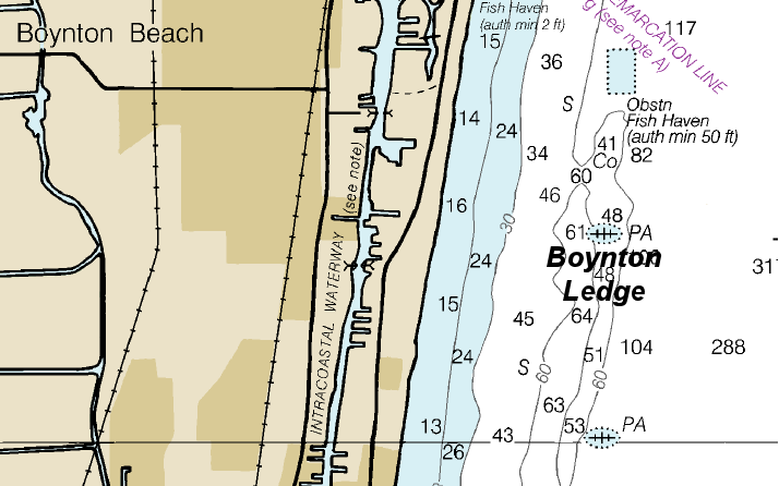
Boynton Ledge |
Reef |
Novice - Intermediate |
26°30.954 N
80°2.176 W |
60' |
|
| |
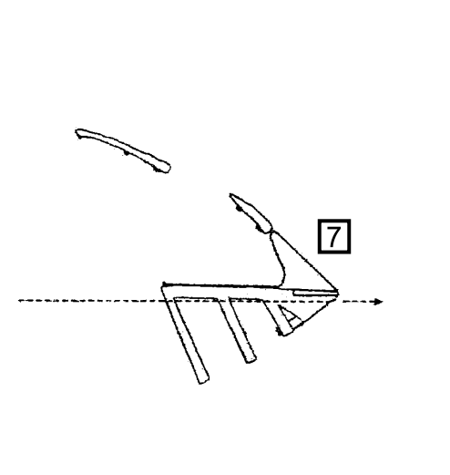
Boynton Ledge runs north to south for about a half mile with a lot of deep undercuts and ledges.
Markers - None.
Details - There are dramatic drop offs from 51' down to 67'.
Marine Life - Moray eels, grunts, snapper, baitfish, groupers, jacks, barracuda, corals, seawhips, fans.
Recommended Certifications - Open Water, Advanced Open Water, Enriched Air (Nitrox), Boat, Drift, Multi-Level, Peak Performance Buoyancy, Coral Reef Conservation. |
|
|
5 |
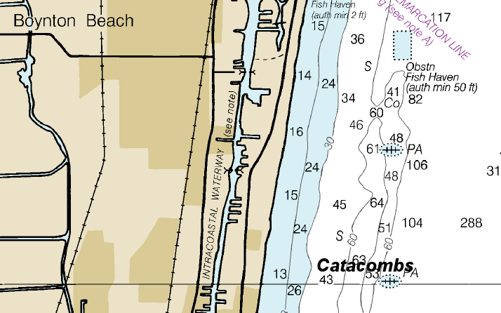
Catacombs |
Reef |
Novice - Intermediate |
26°30.253 N
80°2.268 W |
60' |
|
| |
Markers - None.
Details - Current is light but can be strong at times. The reefs are usually best in the 45-60 foot range.
Marine Life - Tropical fish, hammerhead shark, nurse shark, turtles.
Recommended Certifications - Open Water, Advanced Open Water, Enriched Air (Nitrox), Boat, Drift, Multi-Level, Peak Performance Buoyancy, Coral Reef Conservation. |
|
|
6 |
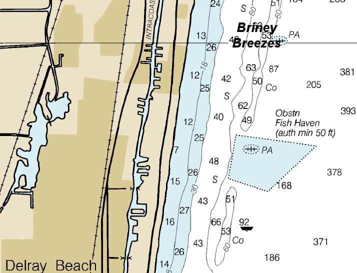
Briney Breezes |
Reef |
Novice - Intermediate |
26°29.696 N
80°2.382 W |
65' |
|
| |
Briney Breezes is a low profile reef with lots of crevices.
Markers - None.
Details - The top of the reef is at 45' and drops to 65' on the west side.
Marine Life - Moray eels, nurse sharks, lobster.
Recommended Certifications - Open Water, Advanced Open Water, Enriched Air (Nitrox), Boat, Drift, Multi-Level, Peak Performance Buoyancy, Coral Reef Conservation. |
|
|
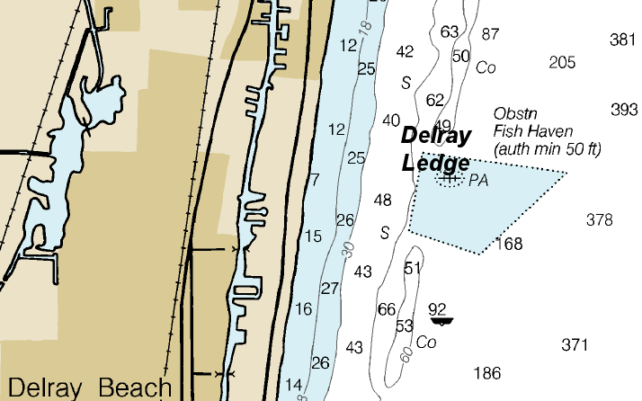
7 |
Delray Ledge |
Reef |
Novice - Intermediate |
26°29.101 N
80°2.454 W |
60' |
|
| |
The reef has long stretches of 15-20 foot high ledges with room-size chunks of broken reef in the sand. There
are also several vertical cracks and tunnels in the reef that provide a great background for photo ops.
Markers - None.
Details - Current is light but can be strong at times. The reefs are usually best in the 45-60 foot range.
Marine Life - Tropical fish, hammerhead shark, nurse shark, turtles.
Recommended Certifications - Open Water, Advanced Open Water, Enriched Air (Nitrox), Boat, Drift, Multi-Level, Peak Performance Buoyancy, Coral Reef Conservation. |
|
|
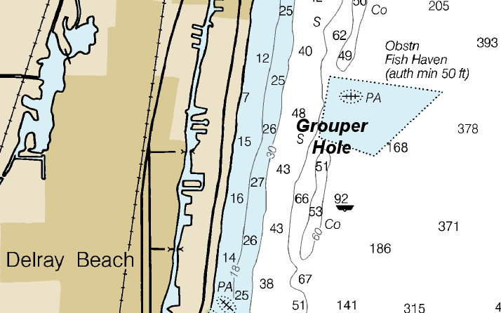
8 |
Grouper Hole |
Reef |
Novice - Intermediate |
26°28.677 N
80°2.546 W |
70' |
|
| |
Grouper Hole has a large arc shaped reef. There are undercut edges with caves and big blocks of coral in the sand.
Markers - None.
Details - The bottom is about 70' and the reef slopes up to about 51'.Current is light but can be strong at times. The reefs are usually best in the 45-60 foot range.
Marine Life - Lobster, grouper, snapper, grunts.
Recommended Certifications - Open Water, Advanced Open Water, Enriched Air (Nitrox), Boat, Drift, Multi-Level, Peak Performance Buoyancy, Coral Reef Conservation. |
|
|
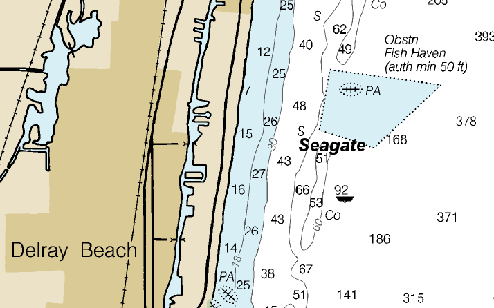
9 |
Seagate |
Reef |
Novice - Intermediate |
26°28.465 N
80°2.433 W |
60' |
|
| |
The inside edge of the reef has a circular hole with a rock ledge across part of the opening.
Markers - None.
Details - Current is light but can be strong at times. The reefs are usually best in the 45-60 foot range.
Marine Life - Tropical fish, grunts, sponges, soft corals, lobster.
Recommended Certifications - Open Water, Advanced Open Water, Enriched Air (Nitrox), Boat, Drift, Multi-Level, Peak Performance Buoyancy, Coral Reef Conservation. |
|
|
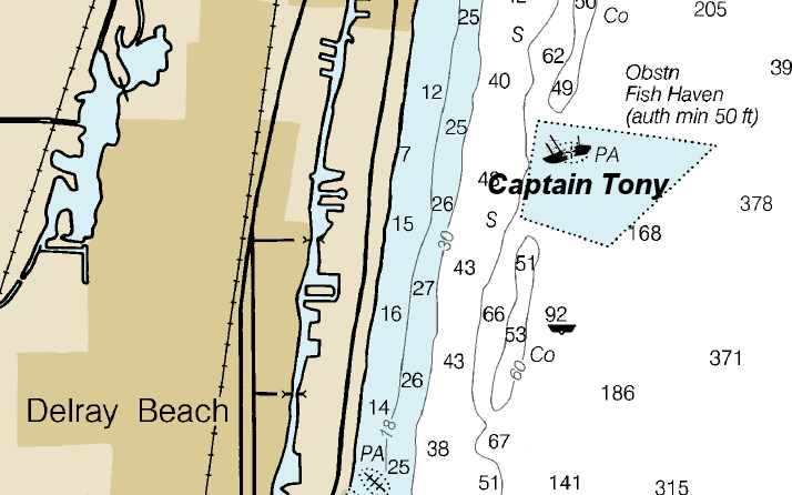
10 |
Captain Tony |
Wreck |
Intermediate - Advanced |
26°28.885 N
80°02.344 W |
90' |
|
  |
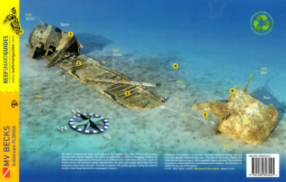
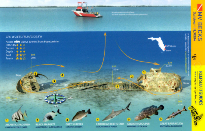
The Captain Tony was sunk on October 22, 1996 in 85 feet of water where she sits upright with her bow to the
South. Originally named the M/V Becks, this 167 foot long Dutch freighter was renamed the Captain Tony in memory of Captain Tony Townsend a local dive charter
captain.
Markers - None.
Details - Ship is broken apart but sits upright on a sand bottom.
Marine Life - Goliath grouper, barracuda, spadefish, snapper, shark.
Recommended Certifications - Open Water, Advanced Open Water, Enriched Air (Nitrox), Boat, Multi-Level, Peak Performance Buoyancy, Wreck, Coral
Reef Conservation. |
|
|
|
|
|
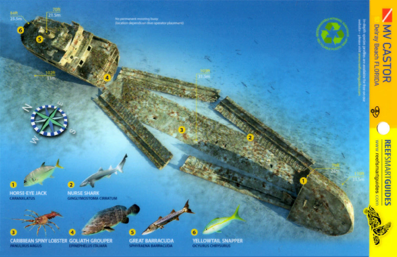
11 |
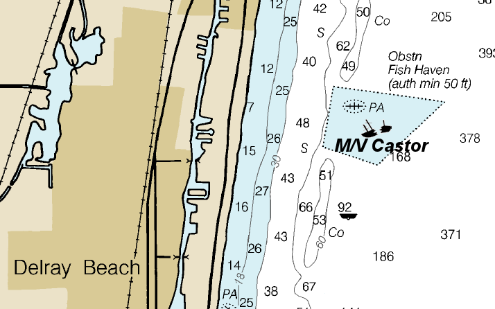
M/V Castor |
Wreck |
Advanced |
26°28.800 N
80°02.200 W |
110' |
|
|
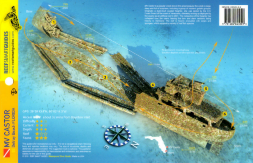
The M/V Castor was sunk on December 14, 2001. She measures 258 feet long and has a beam of 37 feet and is 50
feet tall rising to within 60 feet of the surface. For safety reasons, all hatches and doors have been removed making it easy for penetration. The main deck is at
90 feet and the maximum depth of 110 feet is where it sits upright with the bow pointing south.
She was designed as a dry cargo carrier by the Dutch
as a shelterdeck Coaster used for timbers. The ship was built in 1970 at the Bodewes shipyard, Martenshoek, Netherlands. Upon its completion in 1970 originally
called M/V Dorothee Bos, the ship was used for cargo and supplies until 1988. Under a new name of M/V Mer Star, the captain and the crew embarked from Spain to
Mobile, Alabama and remained working within the Caribbean waters for the last twelve years with several different names.
Markers - None.
Details - Vessel sits upright on a sandy bottom.
Marine Life - Goliath grouper, lobster, shark, snapper, barracuda, jack.
Recommended Certifications - Open Water, Advanced Open Water, Enriched Air (Nitrox), Boat, Deep, Multi-Level, Peak Performance Buoyancy, Wreck, Coral
Reef Conservation. |
|
|
|
|
|
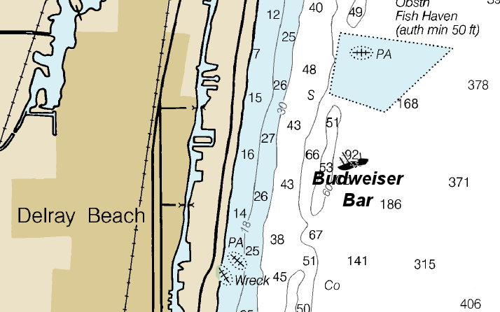
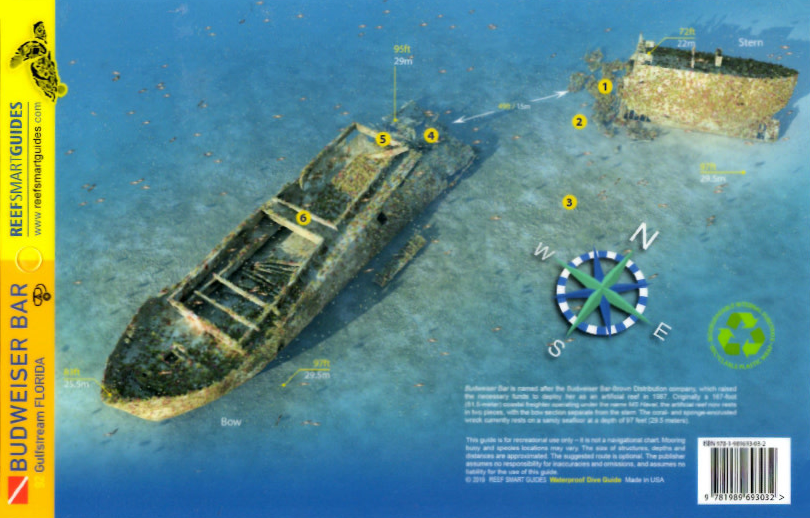
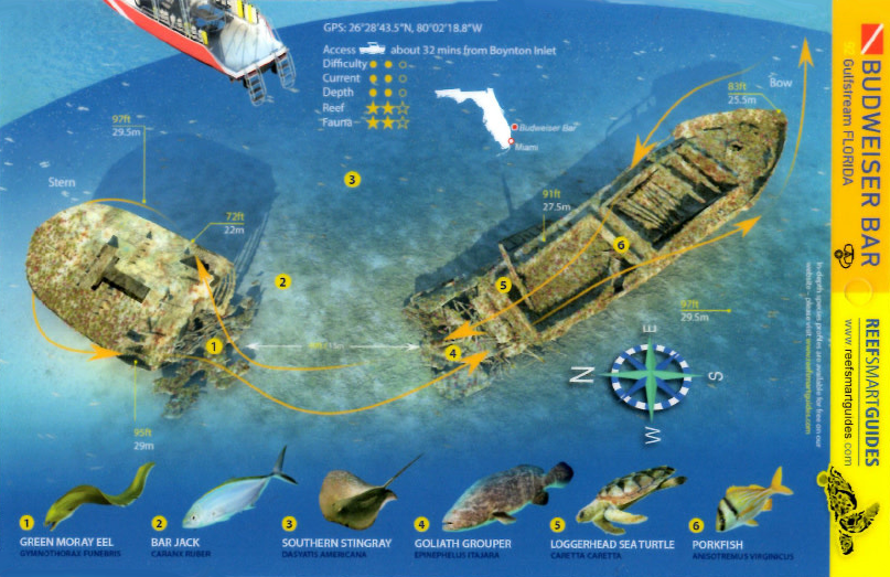
12 |
Budweiser Bar |
Reef |
Intermediate - Advanced |
26°28.465 N
80°2.433 W |
85' |
|
| |
This 167 foot long coastal freighter was built in 1965 and used to transport dry goods to the Bahamas and
Haiti. Her original name was Olive M, but she was renamed, prior to her sinking, after the Budweiser Beer company donated one third of the money needed to create
the reef. She was sunk as an artificial reef in July of 1987.
Markers - None.
Details - Lies upright in 80 feet of water with her stern pointing north. The propeller, funnels and davits on this wreck were left intact, and located on
the deck, there is a large open section where divers can easily enter the wreck.
Marine Life - Tropical fish, hammerhead shark, nurse shark, turtles.
Recommended Certifications - Open Water, Advanced Open Water, Enriched Air (Nitrox), Boat, Drift, Multi-Level, Peak Performance Buoyancy, Wreck, Coral Reef Conservation. |
|
|
|
|
|
|
|
| |
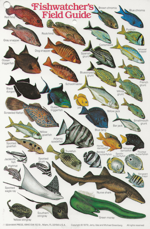
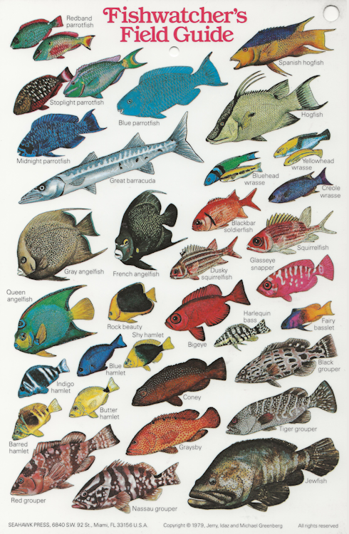
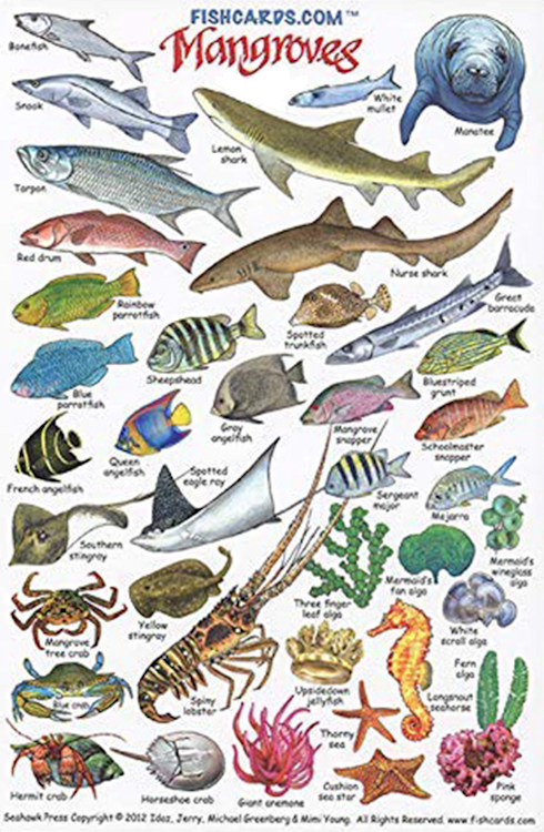
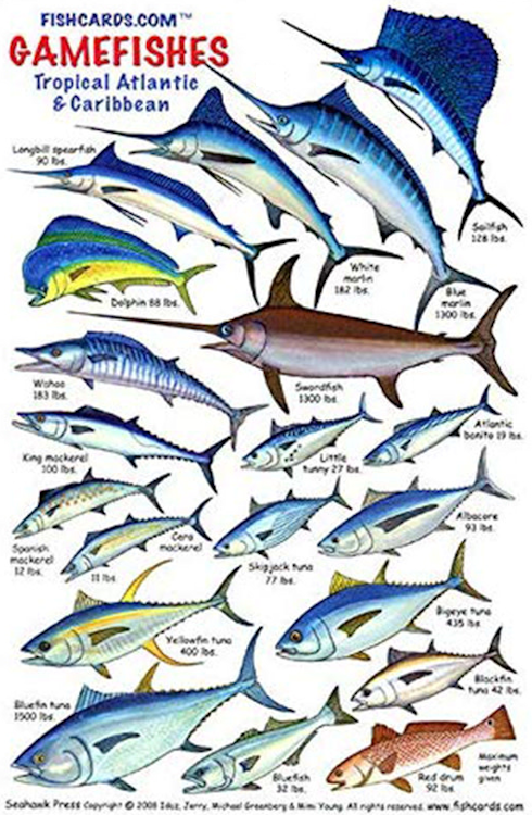
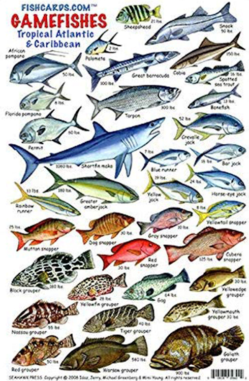
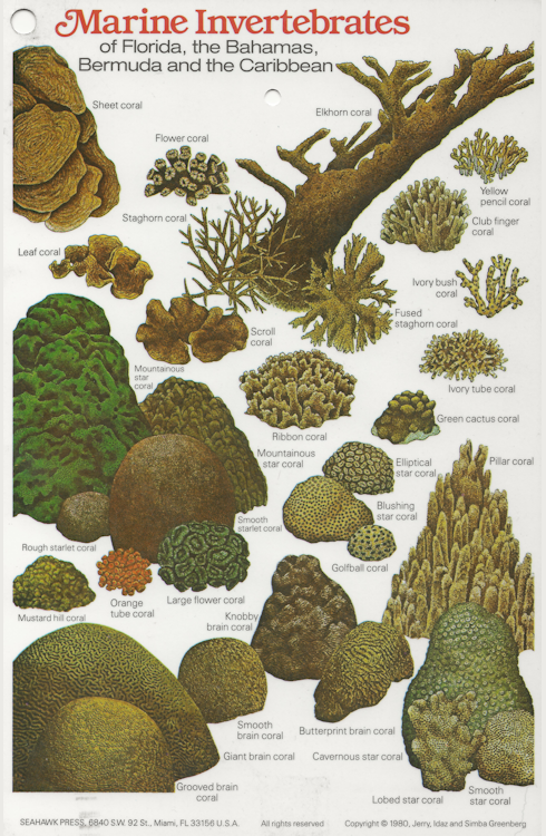
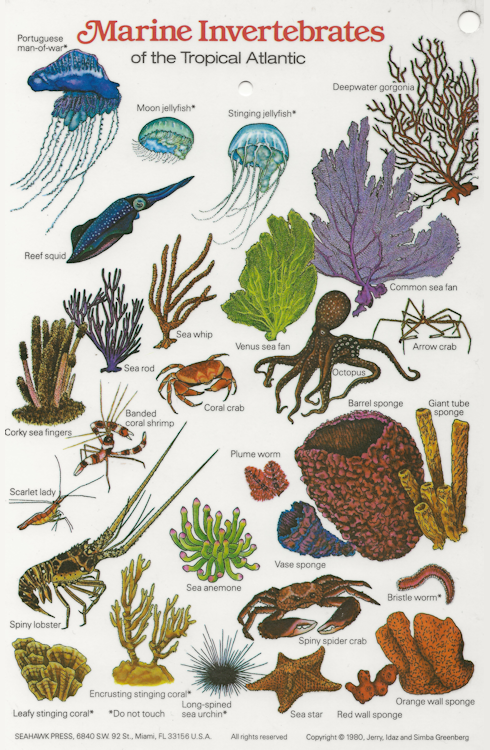
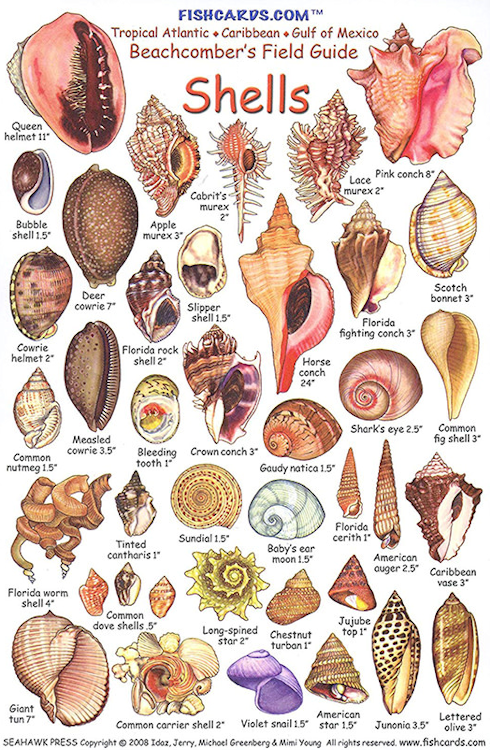
Fish & Coral ID Cards |
|
| Since there are thousands of different species of fish and coral, these ID cards will help you
identify what you see under the ocean. |
|
|
|
|
|
|
|
|
|
|
|
|